
One thing that always excites me when I get to the summit of a mountain is finding a Benchmark. I’m not really sure why, but those small, metal disks are fun to find. Maybe it’s because it represents a piece of history on the mountain. In most cases, they were installed by a previous generation, and will be there for many future generations to come. I decided to do a little research on the subject of them and this is what I have found.
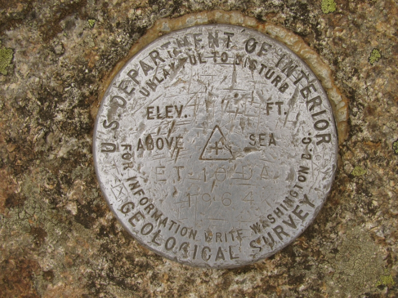
USGS Benchmark on the summit of Mount Liberty
Apparently, these Benchmarks could have been installed by one of two agencies; either the United States Geological Survey (USGS) or the National Geodetic Survey (NGS), formally the US Coast & Geodetic Survey. I would say the USGS Benchmarks are probably the most common, but I have found some older US Coast & Geodetic Survey Benchmarks as well. I have never found one with the newer, National Geodetic Survey name on it.
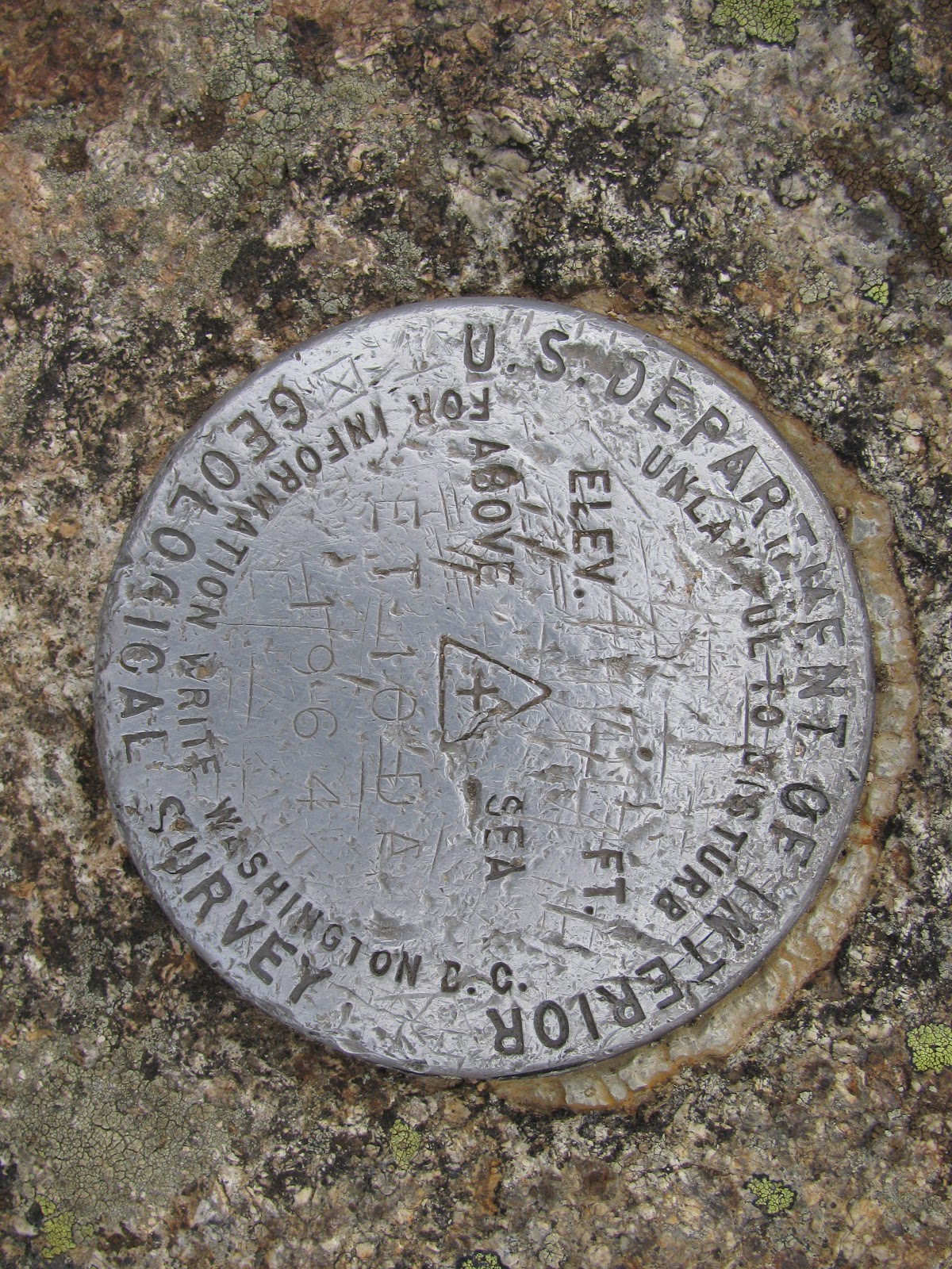
NGS Benchmark and Reference Mark on Mount Lafayette
One of the main jobs of the USGS, with respect to Benchmarking, is topographical mapping. They install these USGS Benchmarks to create an accurate reference point or location (including elevation) that can be revisited in the future. On the other hand, the NGS (if I understand the information I found correctly) determines proper elevations, shore and boundary lines, etc. Both departments use and update Benchmarks as needed for their respective functions.
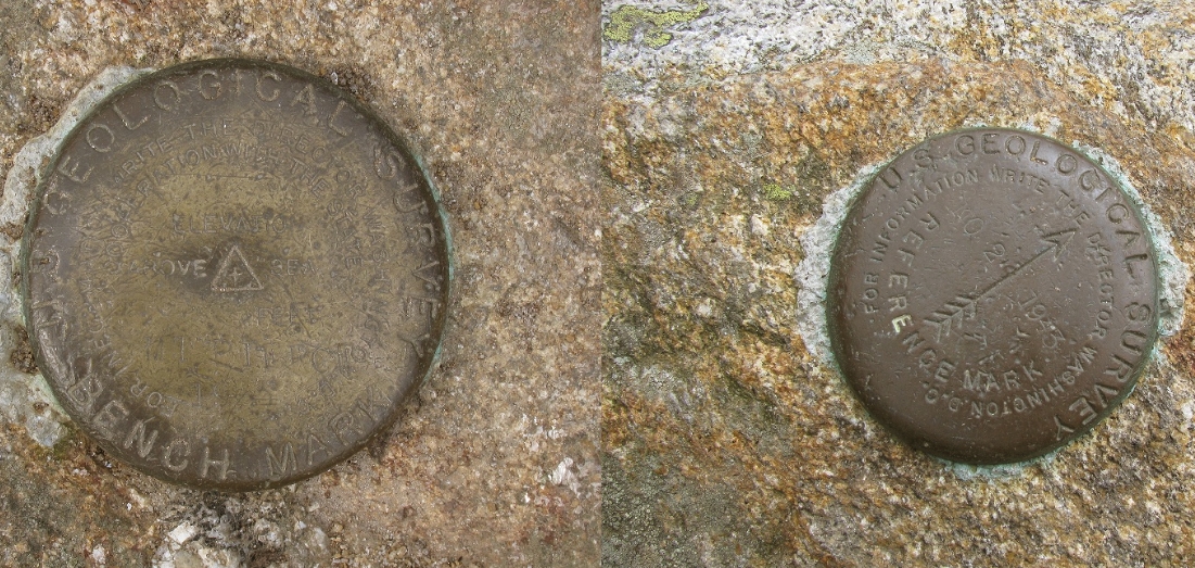
NGS Benchmark on Stratham Hill
Now, a Benchmark could be anything really. It could be a pipe, a rock, a carving in a rock, but we commonly see them on mountain tops in the form of a small, metal disk. The disk usually has the department name that placed it there, the Benchmark’s name (typically, the mountain’s name) and the elevation the disk is placed at. In some cases, the disk isn’t at the true summit or highest point on the mountain. The surveyor will place it in a location that he can point the best line to other peaks or locations for his mapping purposes. Therefore, some summit top Benchmarks may have a lower elevation callout than the actual summit elevation. Most Benchmarks will have a triangle or cross on it, which is a sure sign that it is a true Benchmark. However, there are other disks kicking around these summits that aren’t actually Benchmarks! Don’t let them fool you!
USGS Benchmark and Reference Mark on Mount Pierce
Some Benchmarks are placed along with Reference Marks. In most cases, there are Reference Marks (commonly in numbers of two or more) placed near the Benchmark with a specific direction and distance to help reset or triangulate the Benchmark location if ever needed in the future. These Reference Marks look just like Benchmarks, but have an arrow in the center and are usually marked with “Reference Mark”. I have definitely found a few of these in my travels and thought the mountain either had more than one Benchmark or I apparently didn’t find the true Benchmark, only taking a photo of the Reference Mark. Fool me once…right! There are also Azimuth Marks (directing true direction) and Cadastral Marks (denoting land boundaries) which are used from time to time and look just like a Benchmark. I have never come across either of these types of disks in my travels.
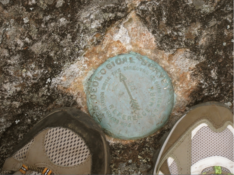
USGS Benchmark and my boot on Mount Washington!
Currently, there is no way of knowing how many Benchmarks have been placed around the United States. It is thought that there is over one million currently placed in various locations, but there is no true record. You can obtain NGS Benchmark datasheets, which contain a lot of information regarding specific Benchmarks, on their website:
http://www.ngs.noaa.gov/cgi-bin/datasheet.prl. As for USGS Benchmarks, information regarding specific ones cannot be found online and you must inquire with USGS personnel to acquire information.
USGS Reference Mark on Iron Mountain…I missed the Benchmark
So, which mountains have I been lucky enough to find these Benchmarks and which ones have I missed? I’m sure you’ve already noticed the photos in this post which have a lot of these peaks mentioned. I’ve found USGS or NGS Benchmarks on Mount Washington, Mount Pierce, Mount Lafayette, Mount Liberty and Stratham Hill. I have found USGS or NGS Reference Marks on Mount Pierce, Mount Lafayette and Iron Mountain. However, I thought at the time, the Reference Mark on Iron Mountain was in fact the Benchmark. So, I never actually found the Benchmark on this mountain which means I will need to revisit it and find it. I know, after reading and viewing other trip reports, I have missed Benchmarks on Mount Osceola, Mount Major, Mount Cardigan, Mount Chocorua and probably many more. I do my best to make a point to look for these Benchmarks as sometimes they are a bit hidden or people are perched on them eating lunch. I also know, now, that a Reference Mark means a Benchmark is close by.
Left, Sandwich Wilderness Bound Mark on Mount Potash
Right, Property Bound at the base of the Pasture Path up to Mount Katherine
These may be considered Cadastral Marks, although I’m not sure
Hopefully, this was informative for you and somewhat interesting. For me, well I love this stuff. Anything that may carry any ounce of history or significance, such as a USGS or NGS Benchmark, is always intriguing to me. I’ll continue to search them out and I hope you do too!
This blog is a New Hampshire Day Hiker’s Blog that may be of interest to hikers in the New England region. Enjoy! http://livefreeandhikenh.blogspot.com/
Read more at Live Free and Hike
Source:
Please Help Support BeforeitsNews by trying our Natural Health Products below!
Order by Phone at 888-809-8385 or online at https://mitocopper.com M - F 9am to 5pm EST
Order by Phone at 866-388-7003 or online at https://www.herbanomic.com M - F 9am to 5pm EST
Order by Phone at 866-388-7003 or online at https://www.herbanomics.com M - F 9am to 5pm EST
Humic & Fulvic Trace Minerals Complex - Nature's most important supplement! Vivid Dreams again!
HNEX HydroNano EXtracellular Water - Improve immune system health and reduce inflammation.
Ultimate Clinical Potency Curcumin - Natural pain relief, reduce inflammation and so much more.
MitoCopper - Bioavailable Copper destroys pathogens and gives you more energy. (See Blood Video)
Oxy Powder - Natural Colon Cleanser! Cleans out toxic buildup with oxygen!
Nascent Iodine - Promotes detoxification, mental focus and thyroid health.
Smart Meter Cover - Reduces Smart Meter radiation by 96%! (See Video).


